My Books on Amazon






There are 72 blog posts for you to enjoy.
From Puyo to Zamora: A Rainy Reconnaissance Mission
February 7, 2026
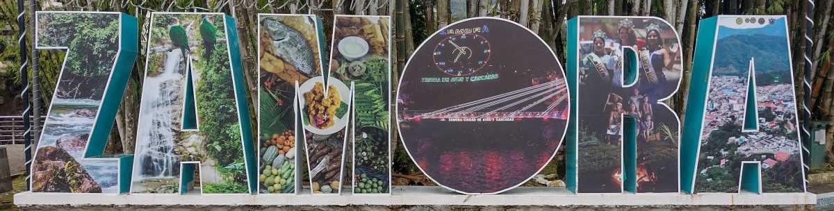
Gualaquiza and Yantzaza, Ecuador, are both in the Amazon region on the eastern side of the Andes Mountains. They are quite wet towns, it rained every day I was in both of them. Gualaquiza is interesting in that they have a much bigger love for volleyball than futbol (soccer). There are only a couple of futbol canchas (fields, though they are more often concret than dirt/sand/grass) in town, and many volleyball courts. Across the street from my hotel room were 2 volleyball courts crowded with people watching the games, and BBQs cooking food. I stayed in Gualaquiza for 3 full days. This was my second visit. I like this town, but the rain has caused me to move it to number 5 on my top 5 list of potential new home towns. I wrote a full blog about Gualaquiza on Aug. 20, 2025.
Read MorePuyo, Ecuador: A Pleasant Amazon Town That Just Works
January 31, 2026

Puyo, Ecuador - on the Amazon side of the Andes Mountains in central Ecuador, has a population of around 34,000 in the town and maybe closer to 40,000 in the metropolitan area. I've been here for four days. This is my fourth visit. That brings me to ten days here. Puyo is an Amazon town, surrounded by the rain forest, with the Rio Pindo Grande running through the town on one side, and the Puyo River running along the other side. Across the Puyo River is all jungle. The town, while not historic or loaded with historic buildings, is a very pleasant place to stay if you're passing through this region.
Read MoreLoreto, Ecuador: A Jungle Town, Not a Tourist Stop
January 24, 2026

Loreto, Ecuador sits in Orellana Province, deep in the Amazon Basin within the Napo River watershed. It's a small cantonal seat with only a few thousand people in town, but the canton itself is massive - more than 2,200 square kilometers (850 square miles) of jungle, rivers, hills, and rough terrain. That territory stretches from lowland rainforest up toward the slopes of Volcano Sumaco and the Galeras range. The town lies along the E20 highway, between Coca and deeper Amazon forest, and functions more as a service and transit hub than anything resembling a tourist destination.
Most of the canton is rural; roughly 90% of the population lives outside the town, including Kichwa Indigenous communities and mestizo settlers - with Loreto itself occupying only a small, settled slice of the larger landscape. It's hot, humid, green, and practical, not a place of tidy plazas or Andean charm. Loreto was officially designated a canton in August 1992, making it a relatively new administrative unit, even though the land and its people have a much longer history.
Read MoreBaeza, Ecuador: Where the History Outgrew the Town
January 17, 2026
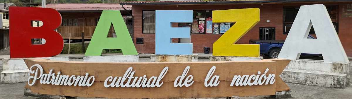
Baeza, Ecuador, sits in the lower slopes of the Eastern Andes Mountains in northern Ecuador. Sitting in a valley at an elevation of 1914 meters (6280 feet), this very small town of around 5000, was founded in 1559. Other than stopping for a meal, there's nothing here to see or do. There's a nature reserve a short drive outside of town, and looking at the Wikipedia page and its mention of a "municipal integrated farm" - well I didn't see any such thing in walking all over the tiny town, and Google maps shows "zoologico" which is typically a zoo or zoo-like place. Are they the same? I don't know, can't help you on that one. And there's the "Old Baeza" neighborhood just a few minutes walk out of the town proper. It's a neighborhood with its own church, a very unkempt "park" or plaza, maybe originally, a few hostals, and a tiny convenience store. At the front, alongside the highway, is a tiny park area with a couple of statues and the city name sign (pics in the photo album). It's all rundown, tired, and not at all what the Wikipedia describes it as.
Read MoreCayambe: High Altitude, Quiet Streets, and a Market That Takes Over
January 10, 2026

Cayambe, Ecuador, also known as San Pedro de Cayambe, was founded in 1824, was reversed in 1851, then reestablished in 1883, and sits at 2839 meters (9285 feet). The town has a population of around 45,000, mostly indigenous people. The town is located in the northern Ecuadoran Andes Mountains and sits on the lower slopes of the Cayambe volcano. The equator is only a few minutes' drive south of town. There is a monument area, but how accurate it is, I don't know, as I didn't go to it. The origin of the name has at least 4 stories, so I'm not even going to delve into that.
Read More
I used to teach English as a foreign language in Barranquilla, Colombia. Now I'm retired and traveling throughout South America.
I'm from Kennewick, Washington, USA. In my previous life, as I call it, I was an IT guy, systems administrator, computer tech, as well as a shipping/receiving guy and also worked as a merchandising guy in a RV/Camping store.