My Books on Amazon


San Antonio, Ecuador
September 18, 2025
San Antonio de Pichincha, Ecuador, AKA Mitad del Mundo, sits about 26 kilometers north of central Quito. The town has a population of about 70,000. The town was formally established in 1901. But, it's history goes back to before the colonial era. The original name was Llanura de Lulumbamba, it means "plain of ripe fruit," that was followed a name change to San Antonio de Lulumbamba and then changed again, when it was formally established in 1901, to San Antonio de Pichincha. Why is it called "The middle of the world" when there are other cities on the equator in other countries? Because it is not only the fact that it is on the equator, but it is also the highest elevation on the equator. Thus making it the closest to the sun of any on the planet, so they say at the museum.
Finding the Equator
When I first arrived here, I had no intentions of staying long. My plan was to go to the equator monument (for the second time) this time to actually see what was there, and then leave the next day. That changed when I discovered the monument is not the location of the equator. I then went to the Museo de sitio Inti-Ă‘an which has a monument on the then updated location of the equator. Then I discovered that the location in that museum was also outdated by new GPS tech, so I went to the actual current location of the equator. It's not where you might expect it.
Once I found it on the map at the corner of Ruta (Route) 28 (the highway westbound out of Quito) and the street called Moraspungo. At the exact location is a dirt lot with three front-end loaders parked in it. When I was there walking around in circles with my phone locating exactlying 0.0000000 one of the loader's drivers came over, smiling, he knew what I was looking for. He said, Yes, their loaders were parked exactly on the spot of the equator passing through there. There is one positive point about this spot - there are no other people competing for a spot in front of a monument to get a photo with each foot in a different hemisphere. That's only a tourist trap now. After I got a photo of the loaders I went across town to another location of the equator that wasn't somebody's house or business. There's a park called Park at the Y (Parque de la Y). That's where the main road 13 de Junio splits in a Y. The park is inside the Y. Right now the park is closed for renovations, but in the park is an excercise area, playground, and basketball courts. There's a big graphical circle painted on the ground in the park. But, again, don't be fooled, it's not the exact location. I stand on the equator in that park you have to be standing in the basketball court. But again - no crowds, not even a sign indicating the equator is there.
Tourist Attractions
Since my plan upon arriving was simple - find the equator, get a pic or two, and leave for my next destination, I didn't bother reading any websites about the town. I expected it was nothing more than suburbs of Quito. Well, now that I was there and am now in another town, and am now writing this blog, I found a website with tourist attractions that I had no idea were there.
- Mitad del Mundo (of course) - this I knew about beforehand, no big deal, tourist trap type of place.
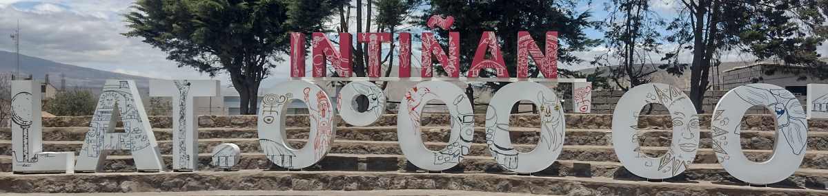
- Museo de sitio Inti-Ñan (Intañan) - this I knew about beforehand, no big deal, also a tourist trap type of place.
Now the list of attractions I found out about after I was long gone from the town -
- Pululahua Geobotanical Reserve - Pululahua is an extinct but active volcano composed of three domes. It is one of the few inhabited craters on the planet and the third largest, measuring 12 km in diameter. The community living in the volcano's crater is made up of about 40 families who make a living from farming and ranching.
References: Wikipedia
San Antonio Virtual - Ruins of Pucará Rumicucho - This is an Inca ruins on a hill at 2400 meters elevation. It is located at 0°01' north latitude. How's that for pinpointing a location when no electronic tech existed?
Reference: San Antonio Virtual - Apu Catequilla Hill - This a very large circular area enclosed in a wall, in it is another cirle. This site was built around 800AD and was built directly on the equator. Reference: Wikipedia
Those are the main attractions, there are a few more, such as the municipal spa (hot springs pools), the town church, and the UNASUR Headquarters.
My Impressions:
It's a bedroom community to Quito, nothing particularly special besides those places I mentioned above. The town plaza and church are nothing special. The "town center" is spread far along on two roads. It's cold, often misty or wet, and I didn't much care for it.

I used to teach English as a foreign language in Barranquilla, Colombia. Now I'm retired and traveling throughout South America.
I'm from Kennewick, Washington, USA. In my previous life, as I call it, I was an IT guy, systems administrator, computer tech, as well as a shipping/receiving guy and also worked as a merchandising guy in a RV/Camping store.