My Books on Amazon


Finding the Equator
September 15, 2025
The Great Toilet Swirl Myth
You’ve probably heard the story: flush a toilet in the Southern Hemisphere and the water spins counterclockwise, while in the Northern Hemisphere it spins clockwise. Sounds neat, right? Too neat. The truth is, the Coriolis effect — the force that makes hurricanes spin different ways depending on the hemisphere — is far too weak to control a couple liters of water in a toilet bowl. What really decides the spin? The design of the toilet, the angle of the jets, and how the water gets pushed into the bowl. The “different directions” trick you’ll see at equator museums is stage magic: tilt the funnel one way, the water swirls one way; tilt it the other, presto, it changes direction. Entertaining, yes. Science? Not so much.
References:
How Stuff Works
Britannica
Live Science
Snopes.com
National Geographic
When the Ciudad Mitad del Mundo monument was built in the late 1970s, survey technology wasn’t as precise. They thought they were right on the line, but GPS later showed the actual equator about 240 meters north of that monument.
Reference: Mitad del Mundo
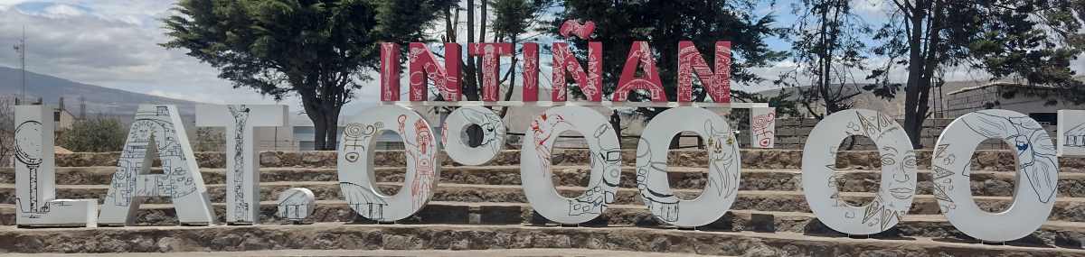
Then came the Intiñan Museum, which cleverly branded itself as “the real equator.” And yes, their painted line is closer, at the time they used a GPS to update the location — but if you pull up Google Earth, you’ll notice the yellow 0° latitude line still runs a bit farther north, across some nondescript bare ground, houses, and businesses.
Reference: Pichincha Es Turismo.com
So in reality:
- Ciudad Mitad del Mundo: Ëś 240 m south of true equator.
- Intiñan Museum: ˜ 100–200 m south of true equator (closer, but not dead-on).
Google Earth’s yellow line: cuts through a quiet stretch of San Antonio de Pichincha, away from the crowds, gift shops, and egg-balancing tricks.
It’s funny — That piece of bare ground near the Museum I mentioned above? I went to it, the very spot of 0.000000000 and found three front-end loaders parked there, on that very spot. I spoke to one of the drivers about it, he smiled and laughed because he knows - the monument and the museum are just tourist traps. The real equator is where he parks his loader.
Another location where you can find the equator is in Parque de la “Y” (the “Y” Park). It sits right where Avenida 13 de Julio splits — hence the name. And yes, that big circular graphic in the middle of the park (if you're looking at the satellite image)? The yellow equator line in Google Earth runs almost through it, just a few meters off. There's a basketball court there, and the equator cuts across that court. It’s one of the few public, open spaces in town where the actual equator line passes, no tickets, no museums, no “spin the water” shows — just a neighborhood park with kids playing fútbol and someone selling ice cream on the corner. But, when I was there, the park was closed for renovations.
So in a way, I found the “realest” equator marker of all: a circle in the pavement where daily life carries on, not a tourist performance. If you could stand in that park, put one foot in each hemisphere, and the only audience would be a couple of kids shooting hoops.
Does the Equator Have Width?
The equator is one of those things that feels physical when you’re standing on a painted line or next to a monument. But in reality, it’s nothing more than math: the imaginary circle halfway between the poles. By definition, it has no width — it’s a razor-thin line at latitude 0°00'00". Anything north is the Northern Hemisphere, anything south is the Southern Hemisphere. Simple as that.
On maps and globes, of course, we humans need to draw it. That thin red or black stripe you see? Depending on the map’s scale, it could actually represent dozens of kilometers in the real world. And on the ground in Ecuador, GPS can place you within a few meters of the true equator, but you won’t see a glowing line in the dirt — just houses, parks, and roads carrying on as if the world’s midline weren’t beneath them. In other words: the equator doesn’t really have width. We just give it one so we can see it, photograph it, and sell keychains about it.
It's similar to La Concordia, a town west of here at the edge of the Coastal Zone. I found the actual 0.000000000 location in a small neighborhood park. No markers of any kind, just a stick that was trying to become a tree surrounded by a circle stones. So, what all of this comes down to is this: if you want to stand with each foot in a different hemisphere for a photo op - go to the Mitad del Mundo or the Museo de Intañan sites - they have just what you want. If you want to stand in a place where the actual equator passes through? That'll be in a park, or alongside a highway, no signs, so crowds.

I used to teach English as a foreign language in Barranquilla, Colombia. Now I'm retired and traveling throughout South America.
I'm from Kennewick, Washington, USA. In my previous life, as I call it, I was an IT guy, systems administrator, computer tech, as well as a shipping/receiving guy and also worked as a merchandising guy in a RV/Camping store.